
 There are many variations of passages of Lorem Ipsum available, but the majority have suffered alteration in some form,
by injected humour, or randomised words which don't look even slightly believable.
There are many variations of passages of Lorem Ipsum available, but the majority have suffered alteration in some form,
by injected humour, or randomised words which don't look even slightly believable.
There are many variations of passages of Lorem Ipsum available, but the majority have suffered alteration in some form, by injected humour, or randomised words which don't look even slightly believable.
There are many variations of passages of Lorem Ipsum available
Menci Software
![]()
Menci provides different software tool respecting application and case history.
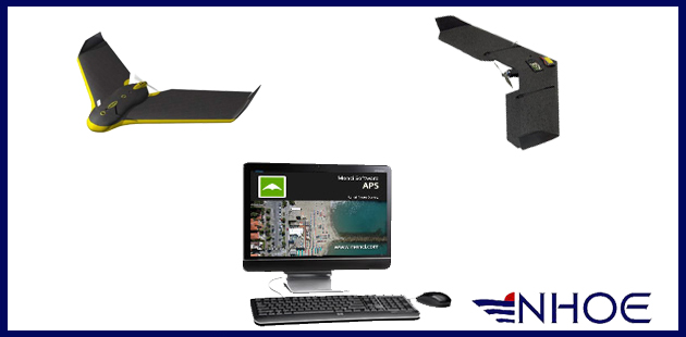
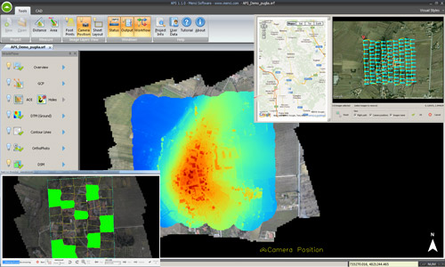
APS
APS is a software suite with high performance for the big production of aerial photogrammetric products starting from small and medium format digital images acquired by UAV drone.
Automatic photogrammetric processing station
APS is the powerful and widely tested photogrammetry software suite for massive and accurate UAV data processing.
APS meets all skill-level users by several interaction steps up to the full automatic process.
It runs on your desktop computer or laptop and processes small and medium format aerial imagery
to 2D maps and 3D models with centimetric accuracy.
APS has three extension modules :
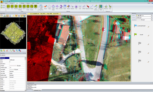
StereoTools
Advanced stereo viewer and editor
StereoTools is a user-friendly digital photogrammetric stereo workstation and allows 3D feature collection.
StereoTools can directly use DTM and bundle orientations produced by APS or other software packages.
Stereo mode navigation is continue. The user can roam seamlessly throughout an entire project of any size.
Vector data collected by StereoTool, or imported from GIS or CAD systems, are superimposed directly onto the stereo models, making it an excellent solution for mapping, change detection and updating GIS data.
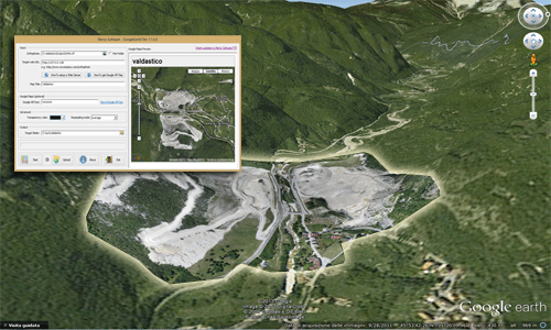
Google Earth Tiler
Orthophoto post processor for Google Earth
Google Earth Tiler makes possible to share your orthophoto on the web, through Google Earth!
Google Earth Tiler is an orthophoto post processor based on open source GDAL library. It builds a KML superoverlay compatible layer, visible in Google Earth and Google Maps.
The input orthophotos are gtiff dataset, produced by APS. The spatial reference system will be automatically extracted and translated to WGS84 needed by Google Earth.
The output data must be loaded in a web space served by an HTTP server to be streamed.
Google Earth Tiler can optionally generate a Google Maps html page, to be published in your website.
A basic FTP client is included in Google Earth Tiler, in order to make easier the upload of your output folder to the remote HTTP server space.
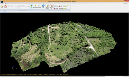
Cloud View
A huge point cloud stream viewer
CloudView is a point cloud stream viewer.
It can open and display clouds of any size generated by APS.
![]() Download the brochure of Menci Software.
Download the brochure of Menci Software.